
By Emily Ansara Baines
It’s no secret that we Angelenos enjoy our fitness. Every week there’s a new workout fad hitting the streets (Flywheel, anyone? Pop Physique? SoulCycle? Orangetheory?) — a new way for us to bring our bodies closer to the celebrities we simultaneously judge and admire. The problem is that many of these fads are expensive, with classes easily costing $30–$50. This makes these forms of exercise fairly inaccessible for any of us starving artists.
But we shouldn’t forget that a cornucopia of practically free exercise opportunities is right outside our doorsteps! Hiking, for example, requires nothing more than nice weather (which we know we have) and a pair of shoes. Below is a list of fun — and sometimes strenuous — hikes in order of their difficulty.
Griffith Observatory West Trail
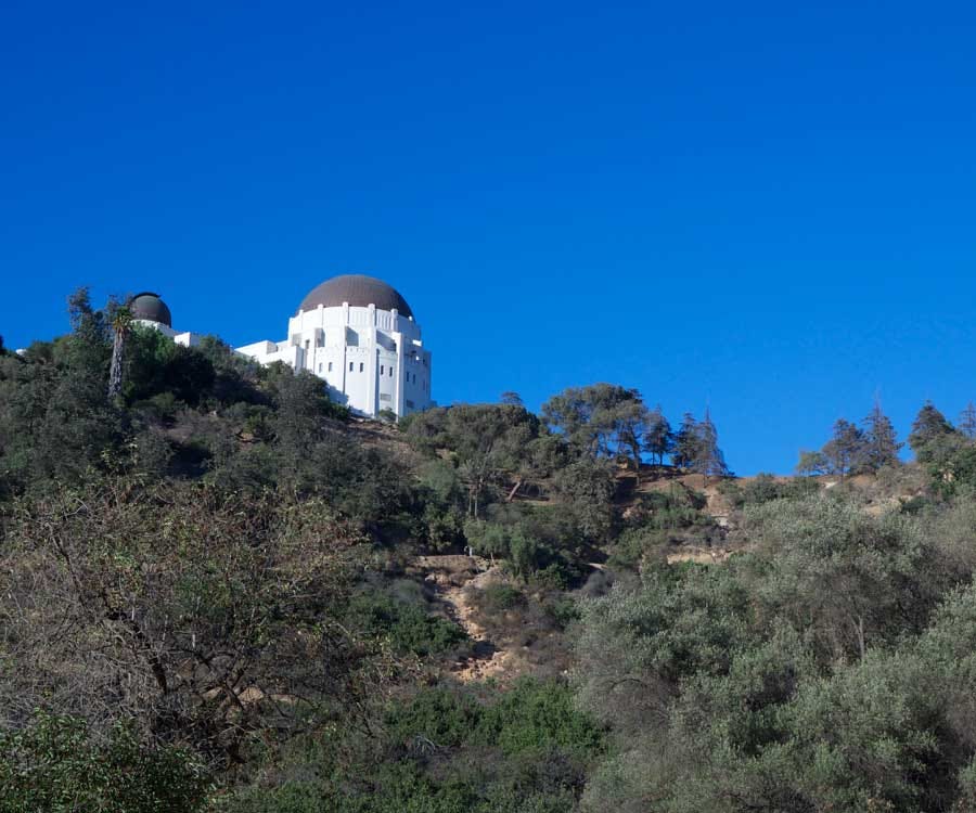
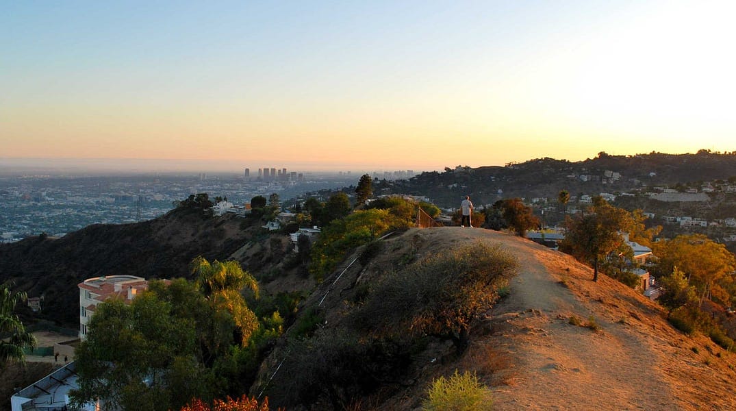
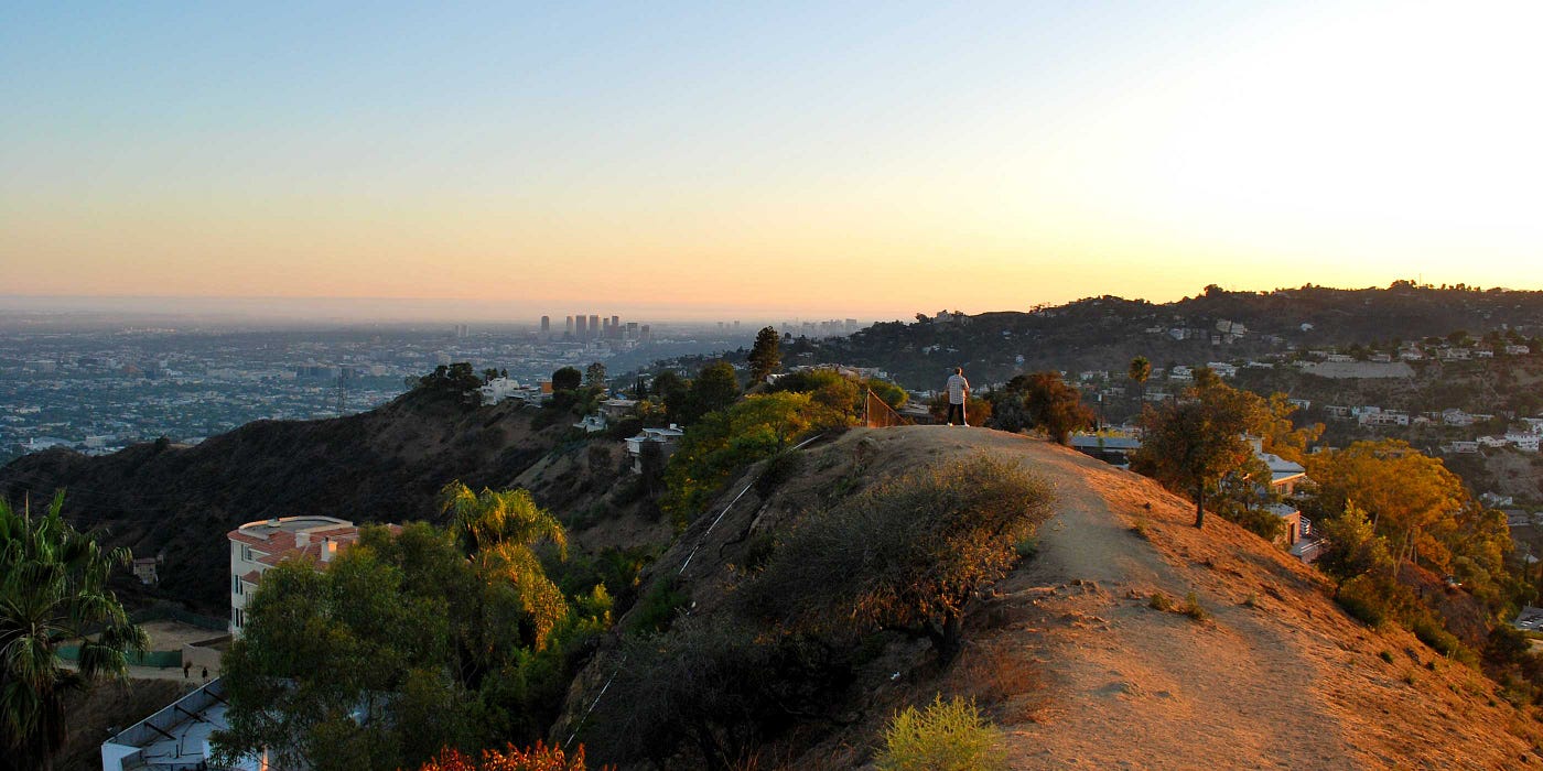
There are plenty of hikes in Griffith Park, but this particular loop (a total of 2.5 miles) is both peaceful and well marked. It’s a particularly fun loop to take your tourist friends on, as the trail ends at Griffith Observatory and provides a spectacular view of the Hollywood Sign and the twinkling lights of Los Angeles at sunset. Along with Runyon Canyon (below), this is also one of the most accessible and popular hikes in the city. Not your scene? There are plenty of other hikes in the Griffith Park vicinity!
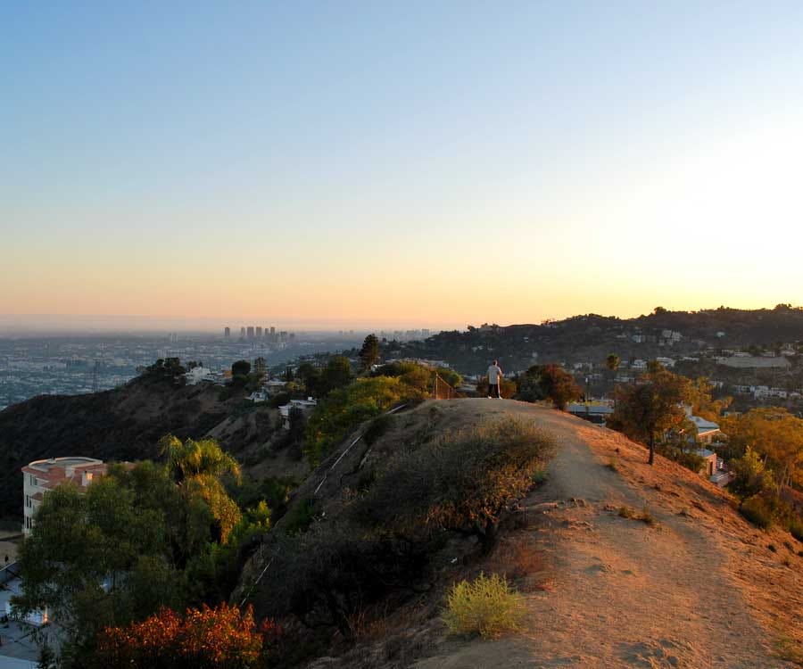
If you want a real slice of L.A. life, this is the hike for you. Perhaps the most typical of local hikes, coming in at 3 miles round-trip, hiking Runyon Canyon puts you up close to your fellow Angelenos. If you’re looking for solitude, this isn’t the trail for you. You can’t walk five steps without hearing an agent making a deal on his cellphone, or pass by a reality star and her small Chihuahua. Yet this also makes the hike all the more enjoyable. The peak of the trail, Clouds Rest, offers a remarkable view of the Hollywood Hills, likely the home neighborhood of more than a couple of your fellow hikers.
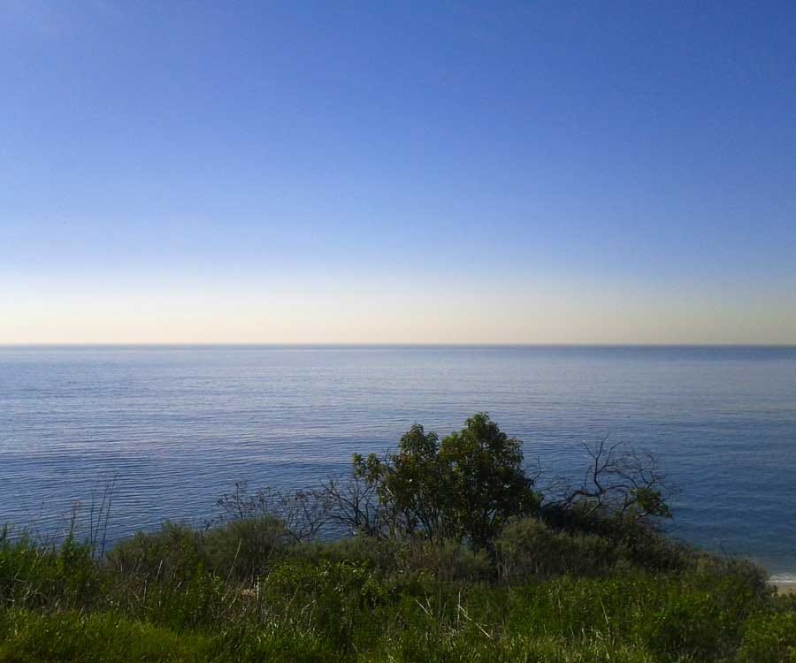
Malibu’s hills provide one hell of a spectacular view. Thus, no Los Angeles hiking guide is complete without a mention of the Solstice Canyon hike located here. (Though depending on traffic, this one might very well take longer than an hour to reach.) Complete with a shaded and well-marked trail — not to mention a babbling brook — the hike offers spectacular views of the ocean before reaching the deserted foundations of a house designed by architect Paul Williams. Hiking to the scenic Tropical Terrace and back makes for a fun and beautiful 3.2-mile hike.
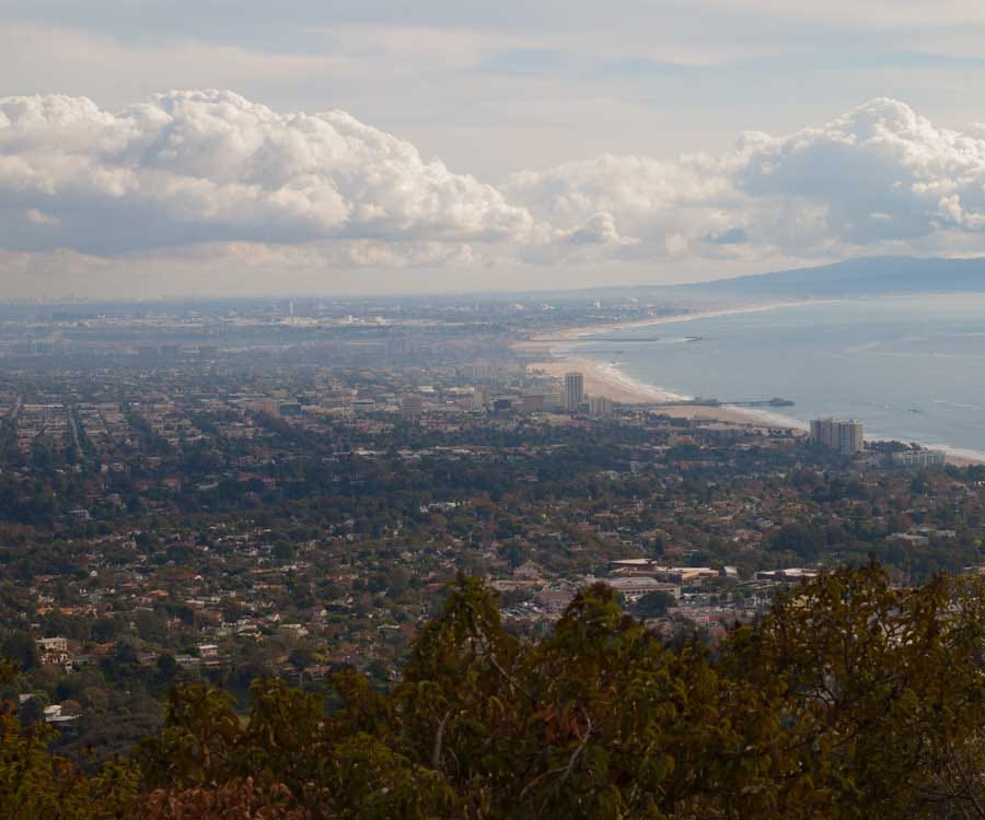
Like Solstice Canyon hike, this trail can also be found on the Westside, this time in the Palisades. Temescal Gateway Park is an incredibly popular park in the Santa Monica Mountains and encompasses 141 acres of oak and sycamore canyons. The loop is 3 miles round-trip, with beautiful views of the Pacific Ocean, a bridge, and tons of native flora and fauna. The beginning of the trail feels like you’re walking through the Shire from Lord of the Rings. Though be careful, a great many Westside runners love to use the park for their workouts on weekends.

Not all hikes have to be on a dirt path! Especially ones that involve an architectural gem, secret stairs, and the Griffith Observatory. This hike takes you past the ritzy homes of Los Feliz, up some secret stairs, and eventually leads you to Frank Lloyd Wright’s famous Ennis House, which you may recognize from the original Blade Runner film. On the way home you can stop by the Griffith Observatory and continue the hike. Just because this trail doesn’t involve as much vegetation as the others listed here doesn’t make it any less strenuous — at nearly 4 miles, your legs will appreciate the workout as much as your eyes will appreciate the view.
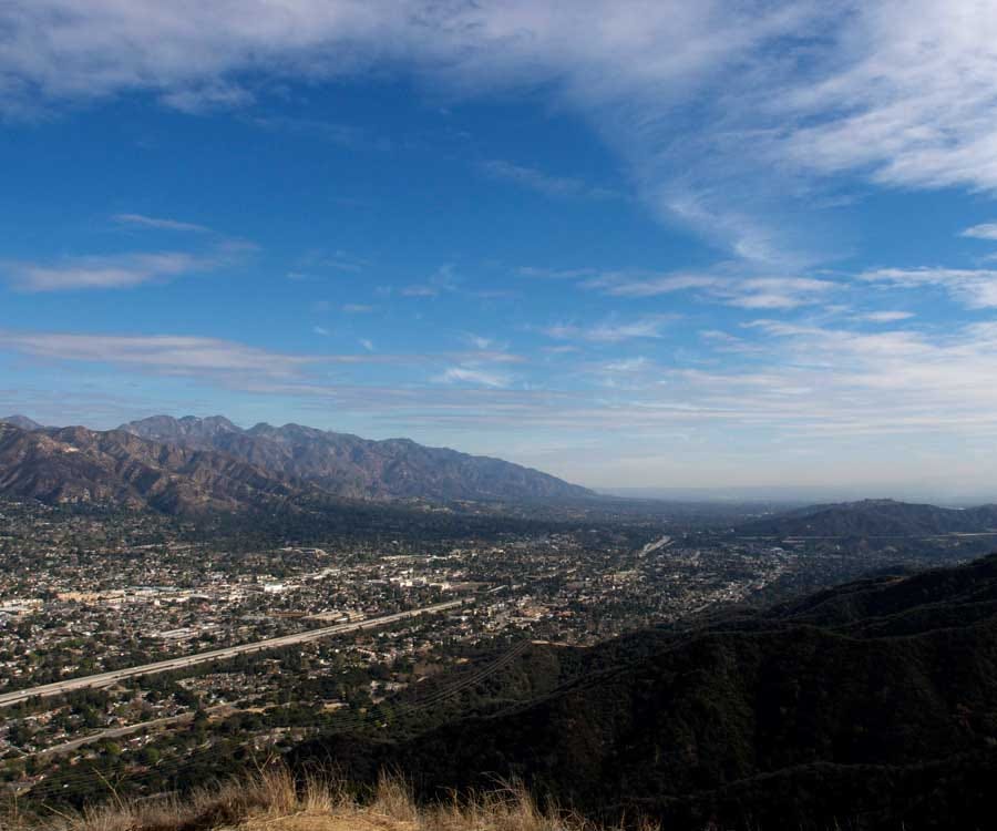
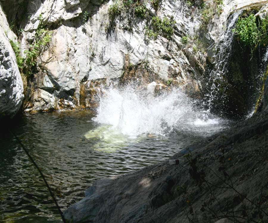
If you grew up in Los Angeles, chances are your high school made you take a field trip to Eaton Canyon. Eaton Canyon Natural Area is a “190-acre zoological, botanical, and biological nature preserve situated at the base of the beautiful San Gabriel Mountains.”[add link] The official website isn’t lying: The area really is beautiful. Eaton Canyon (close to Pasadena in Altadena) is a great place to take your children or friends for a picnic, or it’s just a fun day communing with nature. Don’t forget to check out the Nature Center, which provides education for adults and children alike. Four miles round-trip, the Eaton Canyon Falls hike rewards hikers with a 40-foot waterfall. Please note, however, that I do not recommend the treacherous and unmarked Second Falls hike, which had more than its fair share of tragedy last year. If you are looking for a more strenuous hike near Eaton Canyon, I suggest the Mt. Wilson Trail hike, which can be attempted by those with more experience and stamina.
From first glance, there’s a lot to dislike about this hike: its lack of parking, the fact that the entrance is right off the 210 freeway, the graffiti at the beginning of the trail. But even with all that going against it, this hike is still incredibly pleasant and provides quite the workout for the number of miles it travels. Though the beginning of the hike is straight up hill, don’t be scared — it eventually flattens out. After the first 15 minutes you feel far away from the nearby traffic of the freeway and you will definitely feel the burn on your legs. This is a popular place for families to bring their kids; I recently passed a middle school karate class practicing here too. (The class, unlike me, managed to run up the hill that caused me to nearly finish off an entire water bottle.)
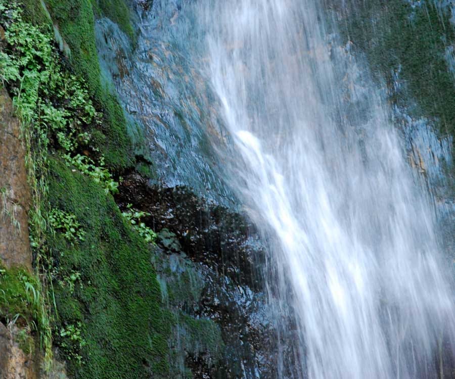
This might be the most popular of the waterfall hikes in our area, and is 4.5 miles out and back — not a bad trek to make for a gorgeous waterfall! Plus, the trail follows a babbling brook, perfect for photos. Bring a picnic in your backpack (along with plenty of water) and, if you’re going during the weekend, be prepared to run into other hikers planning a picnic by the falls.

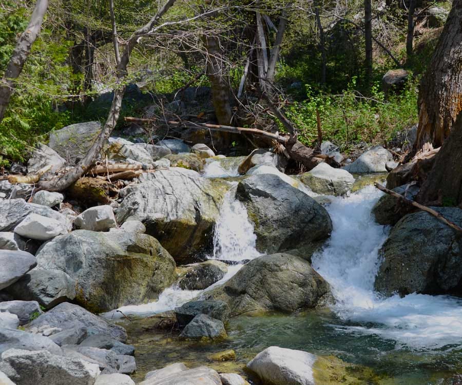
This lesser-known hike is a favorite of mine. At 5.5 miles round-trip with a 1,300-mile incline, this trip can easily become an all-day affair. Located about an hour up the Angeles Crest Highway, this secluded trail provides privacy along with majestic views. (If you’re lucky, you might meet the rare rock climber on their way to attempt some of the impressive boulders in the area.) By the time you reach the peak, you don’t feel like you’re anywhere near LA. The first time I hiked Mt. Waterman, I ended up strolling through the closed grounds of Mt. Waterman ski lifts, an amusing experience that made me wish I knew how to ski.
Ice House Canyon to Ice House Saddle
At 7.2 miles round-trip and an elevation change of 2,600 feet, this is no easy hike — but you are rewarded at its peak (7,500 feet) with a majestic view of the western San Gabriel Mountains. Who needs a New Zealand vacation when you can just go on this hike and pretend you’re already there? Be careful in the winter — snowfall can affect this path, and don’t forget to get an Adventure Pass and a required (yet free) wilderness permit that allows you to enter the Cucamonga Wilderness. The passes and permits can be attained at the ranger station in Mt. Baldy Village. I cannot recommend this hike enough for a strenuous all-day affair … but if you go early in the morning be prepared to have your ass handed to you by the many elderly couples who, impressively, hike here every week.
Top photo courtesy of Ben Godfrey/Flickr; Other photos courtesy of: Emily Ansara Baines; Tommi Virtanen/Flickr; Matt Lucht/Flickr; Peter C in Toronto Canada/Flickr; Tracie Hall/Flickr; Jason Ippolito/Flickr; Dave Snowden/Flickr.
The Bold Italic is a not-for-profit media organization, and we publish first-person perspectives about San Francisco and the Bay Area. We operate under a fiscal sponsorship of a 501(c)(3).
You can become a paid subscriber. Or donate. Or learn more about us.