By Jeremy Lybarger
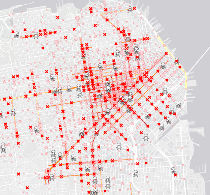
Geary. Leavenworth. Sixth Street. Nineteenth Avenue. These are all thoroughfares where multiple pedestrian fatalities occurred over the last six years. This is according to a new interactive map produced by Vision Zero, San Francisco’s multi-year, multi-million dollar initiative to make city streets safer for pedestrians and cyclists.
The map compiles data collected by the California Highway Patrol between 2005 and 2011. As San Francisco Public Press notes, there were more than 5,325 injuries during those years and 127 deaths. Not surprisingly, collisions occurred most frequently in heavily trafficked areas such as Union Square, Chinatown, the Tenderloin, and Jackson Square. Polk Street — already embroiled in a controversial plan to remove parking spaces and install bike lanes — was particularly dangerous, registering ten severe injuries in almost as many blocks. The Mission (Mission Street, in particular) was also a high-risk zone.
Earlier this month, state senator Carol Liu (D-Los Angeles County) introduced SB192, a bill that would require bicyclists over age 18 to wear helmets (adults aren’t mandated to wear helmets under current California law). Although Liu reported that nine out of every 10 cyclists killed weren’t wearing helmets, the proposal has met with resistance from bicycling advocacy groups that argue the state needs to encourage bicyclists, not create new barriers.
In San Francisco, the city is also considering lowering speed limits below the state’s 25 mph minimum. As we previously reported, in 2014 the city handed out close to 630 speeding tickets per month for nine months — or approximately 21 tickets per day.
Click on the map to check out the city’s most dangerous intersections.
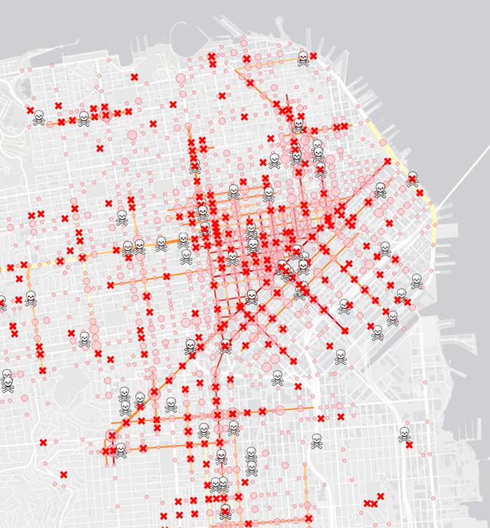
[via SF Public Press; image courtesy of SFGov]
Got a tip for The Bold Italic? Email tips@thebolditalic.com.


