
By Sierra Hartman
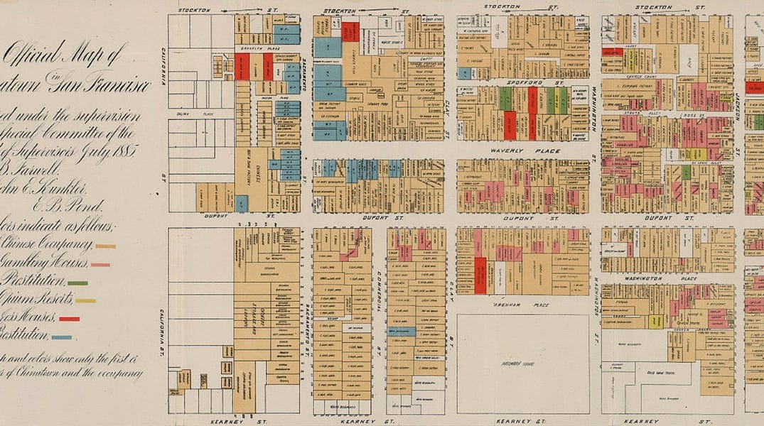
The sights and sounds of inner Chinatown may feel foreign compared to the slick and modern Financial District only a couple blocks away, but it’s worlds apart from the Chinatown of 130 years ago. This may not come as a shock, but seeing the differences mapped out in such detail is pretty intriguing.
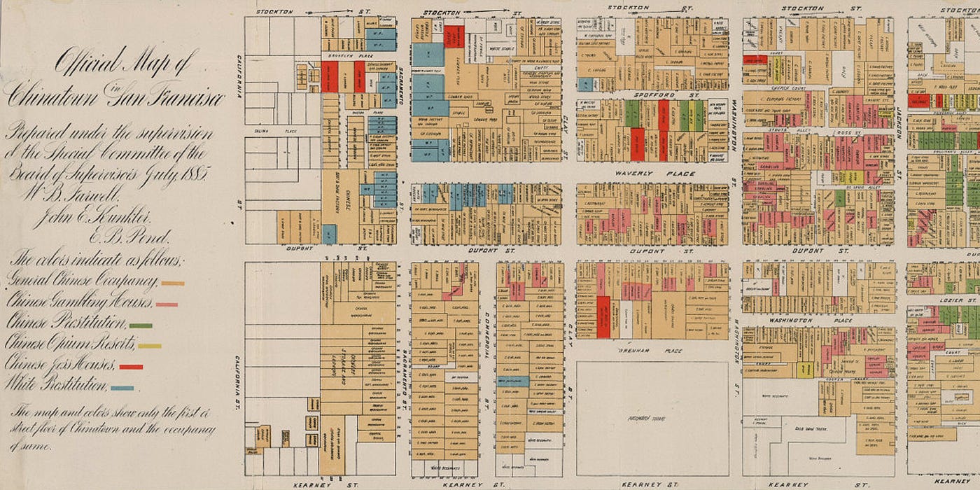
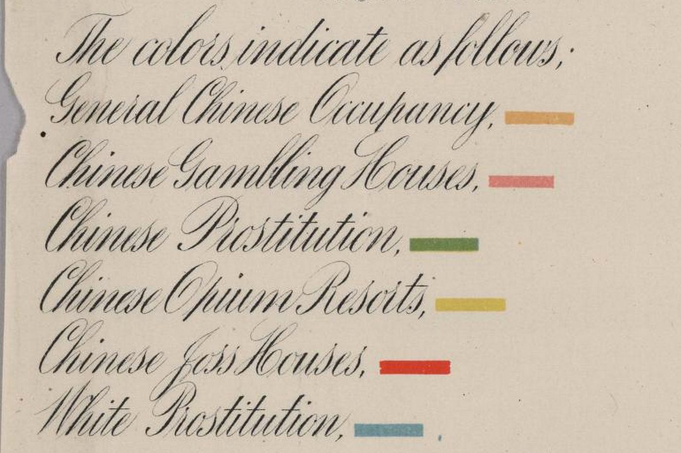
The Gold Rush had packed San Francisco with the rowdiest crowds the west could muster and Chinatown was right in the guts of it. This map was drawn up by the Special Committee of the Board of Supervisors of San Francisco as a report on the condition of the Chinese population of the city. They fastidiously color coded the location of every opium cook and den, various gambling houses, as well as white and Chinese prostitutes.
There was a lot of tension in those days with the influx of Chinese immigrants. Benevolent Associations were established within the community to stem the flow of newcomers and keep the locals from falling into such vices as are noted on this map.
All of this was interspersed with stables, shooting galleries, lumber yards, and a surprising number of cigar factories. The city even thought it pertinent to note the address of a “colored family” at the corner of Stockton and Washington. Check out the hi-res version from the David Rumsey map collection. If you want to take a look at the original map in person, it’s upstairs in the archives at the Main Library on Larkin.
The Bold Italic is a not-for-profit media organization, and we publish first-person perspectives about San Francisco and the Bay Area. We operate under a fiscal sponsorship of a 501(c)(3).
You can become a paid subscriber. Or donate. Or learn more about us.