
Hiking in the Bay Area is what brunch is to New York City. Or what traffic jams are to LA. Or what freezing your ass off is to Chicago. You get the picture—it’s a very common activity.
Getting outside is a lifestyle here, and with good reason. There isn’t anything the region doesn’t offer when it comes to the outdoors. Hiking, over all else, is the most convenient way to experience the best of what we have in our backyard. For many of us, though, the problem is figuring out where to go and which trail to conquer. The seemingly limitless options can be overwhelming. Will it be too hard? Too short? Too cold? Boring?
So if you’re looking for a rewarding hike that will leave you feeling accomplished but not dead, check out this list of trails that will never fail you.
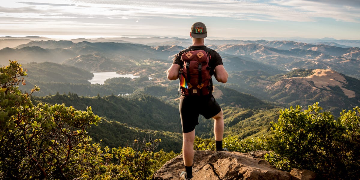
1. Mount Diablo | Mary Bowerman Interpretive Trail and Juniper Trail/Summit Loop
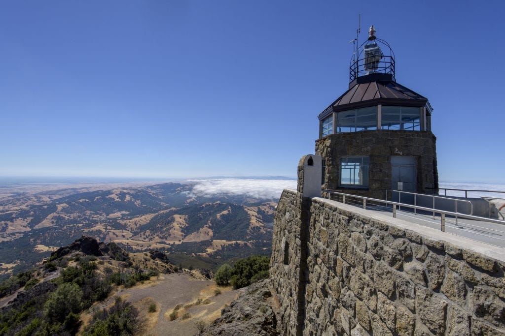
On many hikes, the reward is the climb to the top. But at Mount Diablo, one of the region’s highest peaks, located in the East Bay past the towns of Clayton and Danville, the summit can be the best place at which to start.
A 45-minute drive up the windy road from the base of the mountain leads to a handful of simple trails. A good one to start with is the Mary Bowerman Interpretive Trail, which allows for more of a stroll than a hike around the peak of the summit since it’s only half a mile long. But take your time, because this trail offers some of the best views in the entire Bay Area. On a clear day, it’s even possible to catch a glimpse of Half Dome in Yosemite, about 150 miles away.
If Mary Bowerman isn’t enough, you can also choose to continue on to the Juniper Trail / Summit Loop. This one is a bit longer, and it will take you about two hours to complete thanks to some varied elevation. The trail is steep at times, so expect to break a sweat, but it’s not overly difficult—just challenging enough to make you feel accomplished. And it’s all worth it as you return to the summit, where the path clears to those spectacular views.
- Distance: 4.2 miles out and back (half mile for the Mary Bowerman Interpretive Trail and 3.7 for the Juniper Trail / Summit Loop)
- Best time to go: Early spring and late winter are best, as those seasons are the least cloudy, allowing for better views. Arrive any day before 10:00 a.m. to deal with fewer crowds. The park opens at 8:00 a.m. and closes by sunset.
- Dogs allowed?: No
- Things to keep in mind: There’s a $10 entry fee for cars driving to the summit.
- More resources: Mount Diablo State Park’s official home page
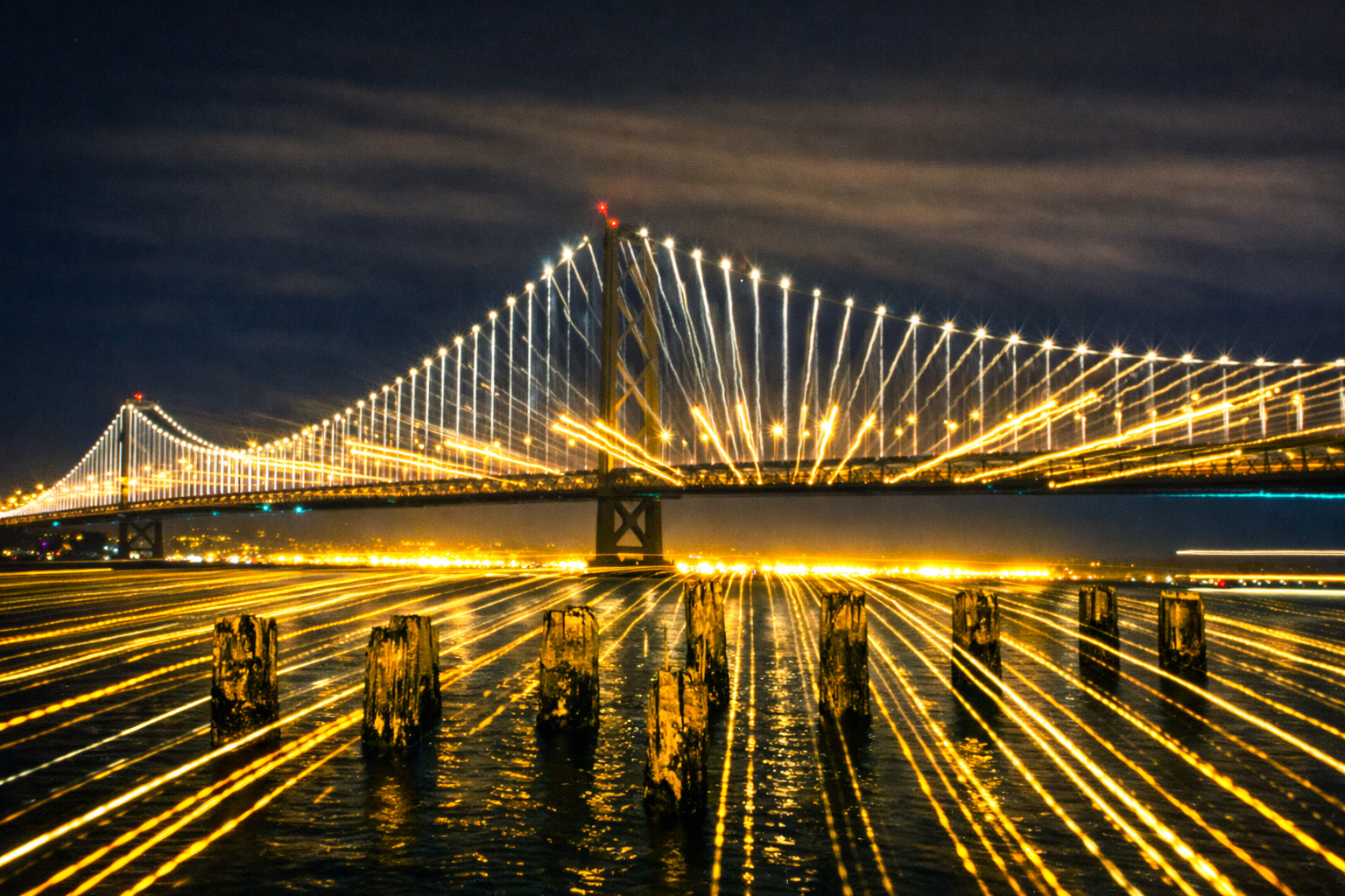
2. Mount Tamalpais—Matt Davis Loop / Steep Ravine Loop
This North Bay hike offers one of the best places at which to see lush forest greenery collide with the Pacific coastline. The 6.4-mile round-trip hike begins at Stinson Beach with the Matt Davis Trail, which has a mix of moderate and steep hills on the way up to Mount Tamalpais. When you reach the Pantoll Campground, you’ll have reached the end of this part of the hike—a sign that you’re halfway through.
From Pantoll, follow the signs toward the Steep Ravine Trail. Water runoff forms a creek that runs through the forest, making for a few cascading falls. Redwoods tower overhead and provide a nice amount of shade as you hike your way back to Stinson.
With a break at Pantoll, it took my friends and me about four hours to finish this hike. It shouldn’t be longer than that if you take your time, like we did. There’s no need to rush considering that the beach will be waiting for you as you finish.
- Distance: 6.4 miles out and back
- Best time to go: Great to visit year-round. But early spring is best, as the weather is warmer and the coastline is less foggy. Come early (before or by 9:00 a.m.) to beat the crowds. Mount Tamalpais State Park opens at 7:00 a.m. and closes at sunset.
- Dogs allowed?: No
- Things to keep in mind: Bring a light coat, as it can get chilly.
- More resources: Mount Tamalpais State Park’s official homepage
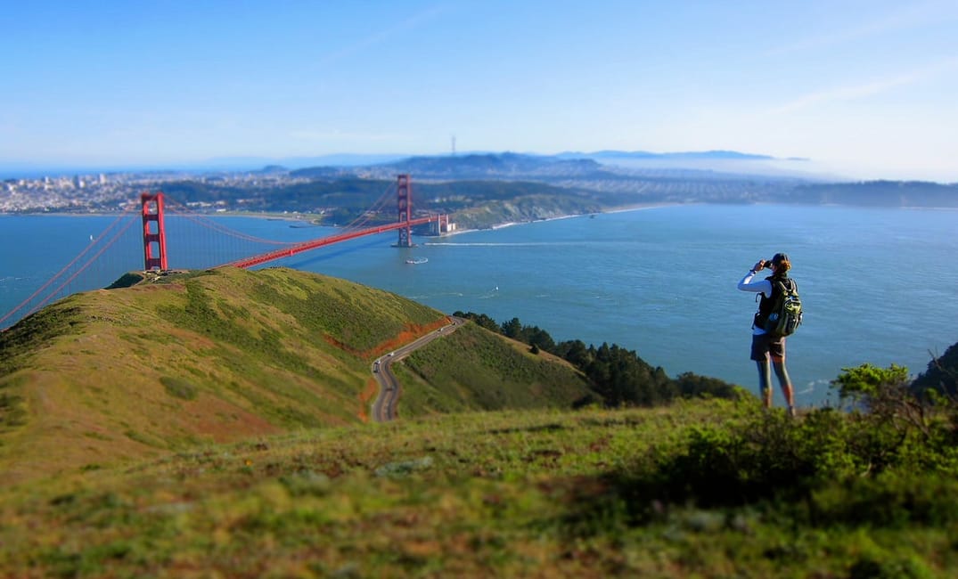
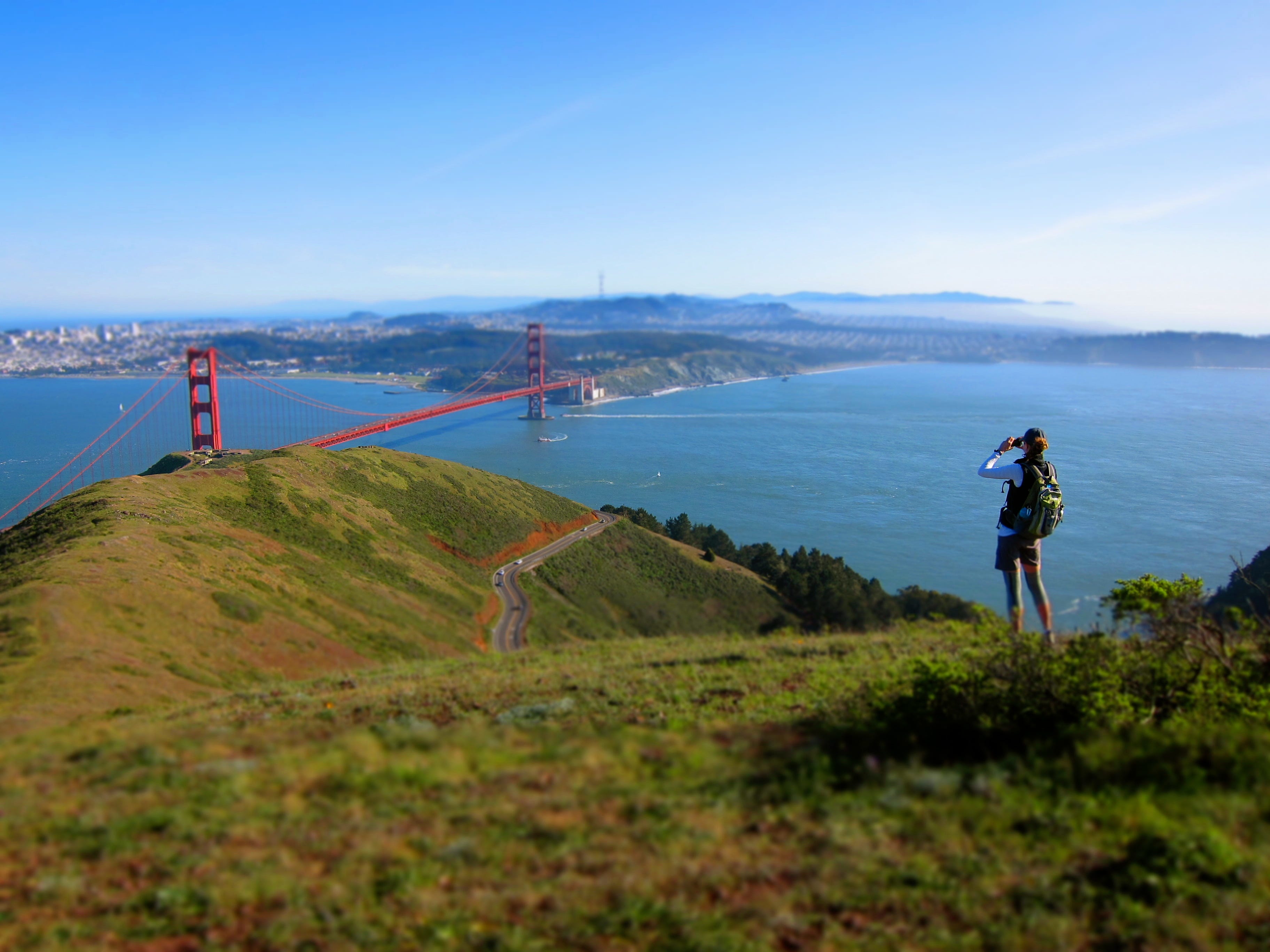
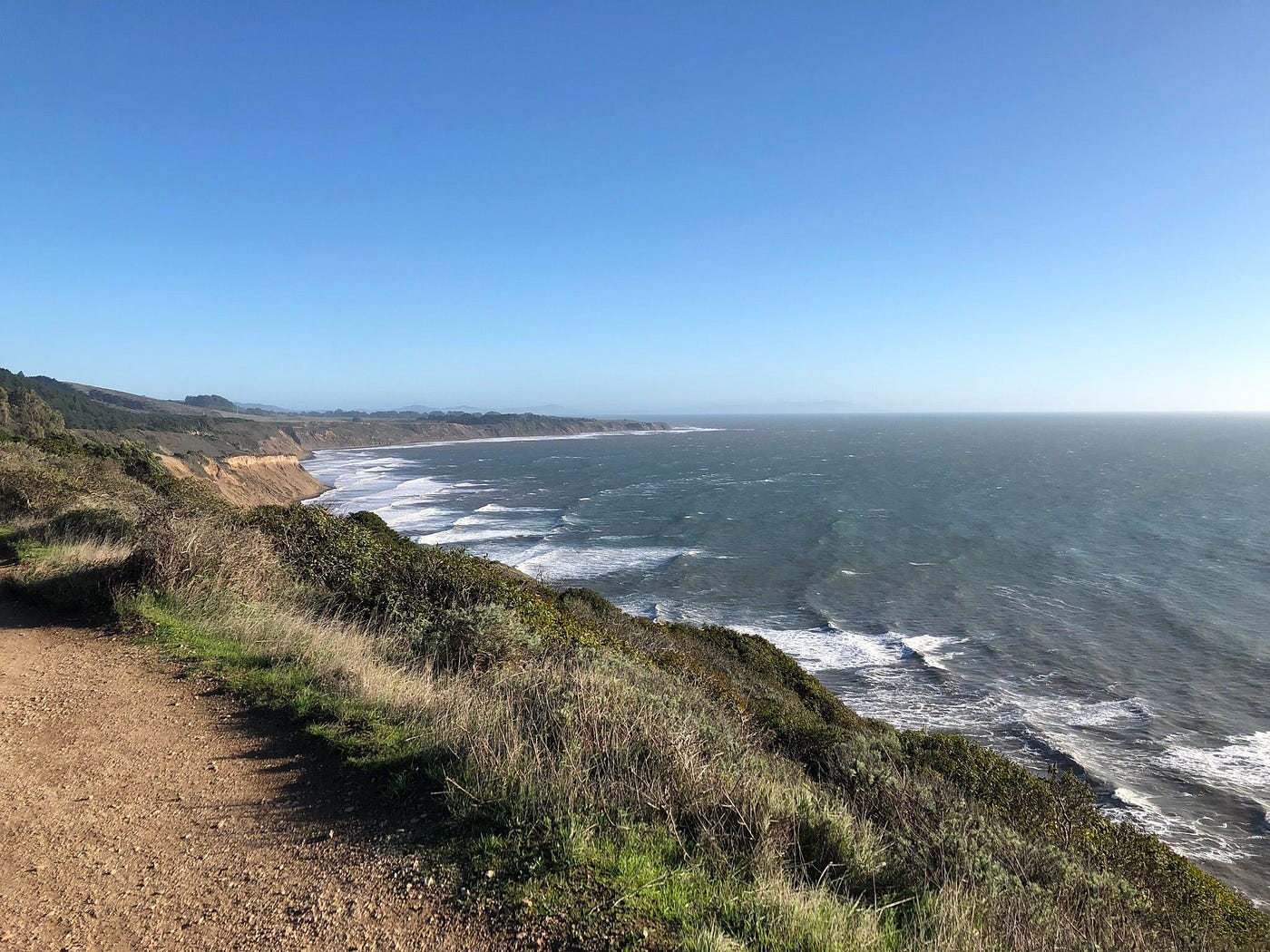
3. Marin Headlands — Muir Beach Through the Tennessee Valley
The Marin Headlands are home to some of the Bay Area’s most iconic scenery and wildlife. You can find it right next to the Golden Gate Bridge, a stone’s throw west of the city of Sausalito. Hiking from Muir Beach through the Tennessee Valley gives you one of its best points of view.
With steep and rocky terrain, this nine-mile hike might present you with a bit of a challenge. The elevation gain reaches close to 2,000 feet, which is something my friends and I weren’t ready for when we hiked here. Still, we managed to enjoy ourselves while powering our way through the trail. The views make it seem less demanding and more rewarding.
Plan to spend an entire day tackling this hike. My friends and I finished it in about six hours. We weren’t in a hurry and set aside a few water breaks along the cliffs. This is a hike you’ll never regret doing.
- Distance: 9 miles out and back
- Best time to go: Any time of year is great, but check the weather before you visit. The Marin Headlands are chilly, foggy, and windy year-round. Before or by 9:00 a.m. is a good time at which to start this hike.
- Dogs allowed?: No
- Things to keep in mind: Start this hike from the Muir Beach Trailhead, where parking is free. The lot stays open from sunrise to sunset.
- More resources: Muir Beach — Golden Gate Parks’ Conservancy homepage
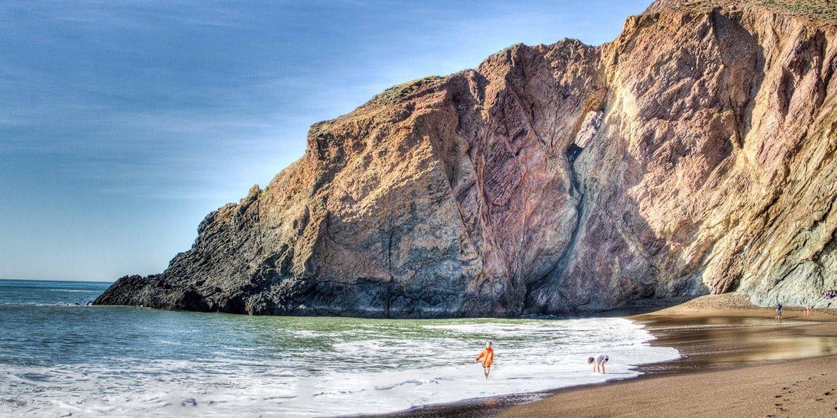
4. Point Reyes — Palomarin Trailhead to Alamere Falls
Point Reyes National Seashore is another must-hike region in the North Bay. Located on the Marin side of the Golden Gate Bridge, past the small town of Bolinas, it’s the home of several fantastic trails that are all worth exploring. Try the Palomarin Trailhead to Alamere Falls if you’re having a hard time deciding which one to choose.
This 7.5-mile hike will treat you to some of the best panoramic vistas the Bay Area has to offer. From the steep, rocky cliffs, you’ll enjoy the sights and sounds of waves crashing on the beach below. These views of the Point Reyes coastline come early in the hike, so make sure to stop and take it all in.
There are other routes you can go starting from the Palomarin Trailhead. But the most popular choice is the way to Alamere Falls. To reach the falls, follow the trail to the Wildcat Campground. From there, the falls are only a one-mile hike south from Wildcat Beach. In total, this route takes about four to five hours to finish.
- Distance: 7.5 miles out and back to Alamere Falls
- Best time to go: Perfect anytime, but it’s chilly all year round. The park is open to visitors every day of the year from 6:00 a.m. to midnight, so come early to beat the crowds.
- Dogs allowed?: No
- Things to keep in mind: Be aware of the tide at Wildcat Beach. If you want to visit Alamere Falls, it’s not accessible during high tide.
- More resources: Point Reyes National Seashore — National Park Service website
5. Napa—Alston Park
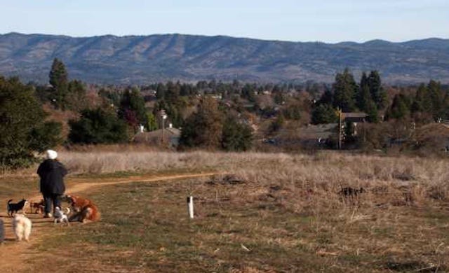
Take a break from wine tasting with a hike in Alston Park, located on the northwest side of Napa. It’ll take you less than two hours to explore in total, making it a perfect pitstop to Yountville, Rutherford, or St. Helena. But Alston Park is worth a visit thanks to the panoramic views it offers of the Napa Valley.
With 30 acres of off-leash area for dogs, this Bay Area hike is great for pet owners. If you have a dog, the Prune Picker Trail is where you’ll want to go. The plum trees found in the orchard there come alive with white blossoms in the winter.
The Dry Creek Trail, meanwhile, offers a little more difficult terrain. But the benefit is that this part of the park has some of Napa’s best views. You’ll get a clear perspective of the region’s vineyards and rolling green hills. It’s great for trail running too.
- Distance: 2.5-mile out and back (Dry Creek Trail)
- Best time to go: Spring is best thanks to milder temperatures. Alston Park is open every day from sunrise to sunset.
- Dogs allowed?: Yes, but they can off-leash only in designated areas.
- Things to keep in mind: There’s not much shade at this park, so prepare yourself for the heat due to sun exposure.
- More resources: Alston Park — City of Napa website
The Bold Italic is a not-for-profit media organization, and we publish first-person perspectives about San Francisco and the Bay Area. We operate under a fiscal sponsorship of a 501(c)(3).
You can become a paid subscriber. Or donate. Or learn more about us.