

By Sierra Hartman
After this week’s spattering of rainfall, the Bay Area’s scenic waterways have gotten a nice little boost. Obviously, the more it rains, the more water you’ll see in waterfalls, and most of these waterfalls are doing all right. Even if they’re running a little low, they’re all in beautiful areas and are well worth the trip.
A few of these waterfalls also happen to be near some of the best campgrounds in the Bay Area, just in case you’re up for more than an afternoon trek. These are just some of my favorites, so if you have any more good waterfalls to recommend, be sure to mention them in the comments.
Alamere Falls
- Hiking time: 2 hours each way
- Total distance: 8.2 miles
- Trail difficulty: moderate
- No dogs, no bikes
- Directions
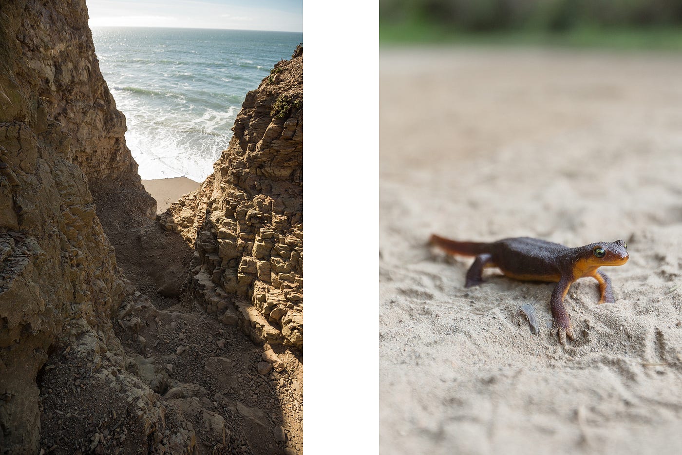
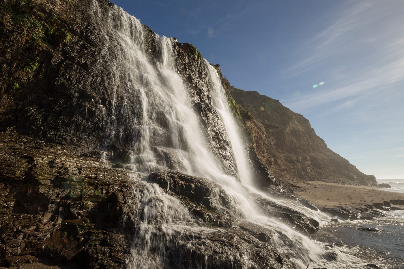
Alamere Falls is the rock star of Bay Area waterfalls. Not only is it one of the most dramatic locations, falling right onto the beach, but it’s also one of the most reliably high-flowing falls around. The hike to Alamere Falls is the longest on the list, but it keeps a fairly even elevation most of the way. The first mile snakes along a 300-foot cliff overlooking the water, and the rest goes between covered forest and exposed chaparral.
To get down to the beach, you’ll have to scramble 60 feet down a gravelly cliff. It’s nothing crazy, but you will definitely have to use your hands. Climbing back up can be tricky, and the rocks are very loose and crumbly. If you’re not feeling particularly agile, you can take an alternate route north to Wildcat Campground and then walk back down to the falls along the sand. It should be passable at most tides, but be sure to check high-tide times before you go. The alternate route will add about 2.7 miles each way.
Cascade Falls
- Hiking time: 20 minutes each way
- Total distance: 1.5 miles
- Trail difficulty: easy
- Dogs OK, bikes OK on fire roads only
- Directions
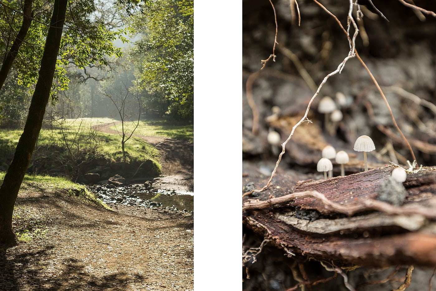
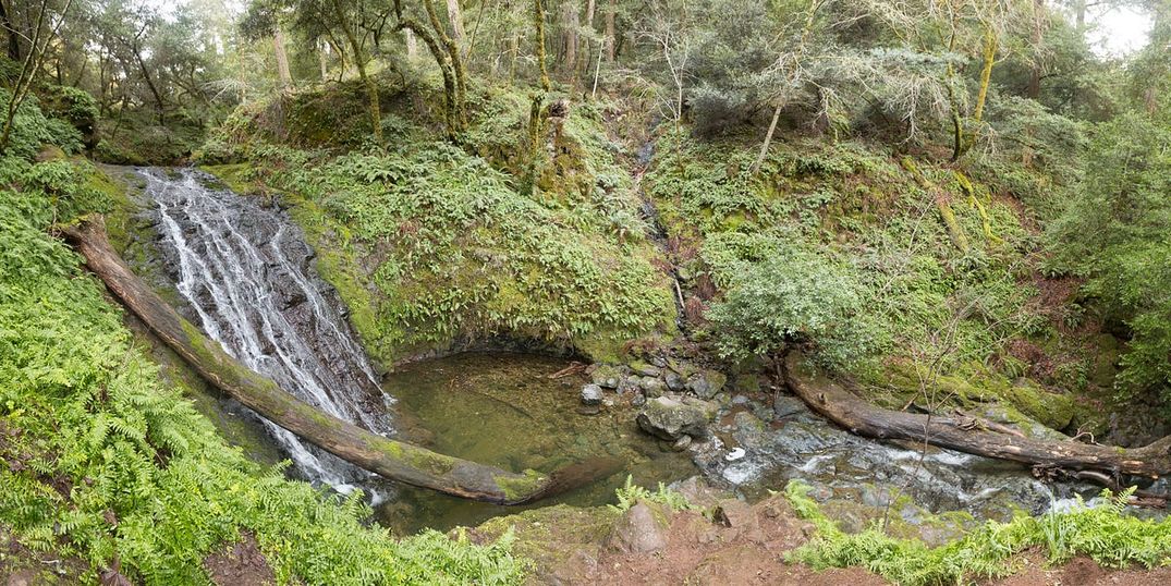
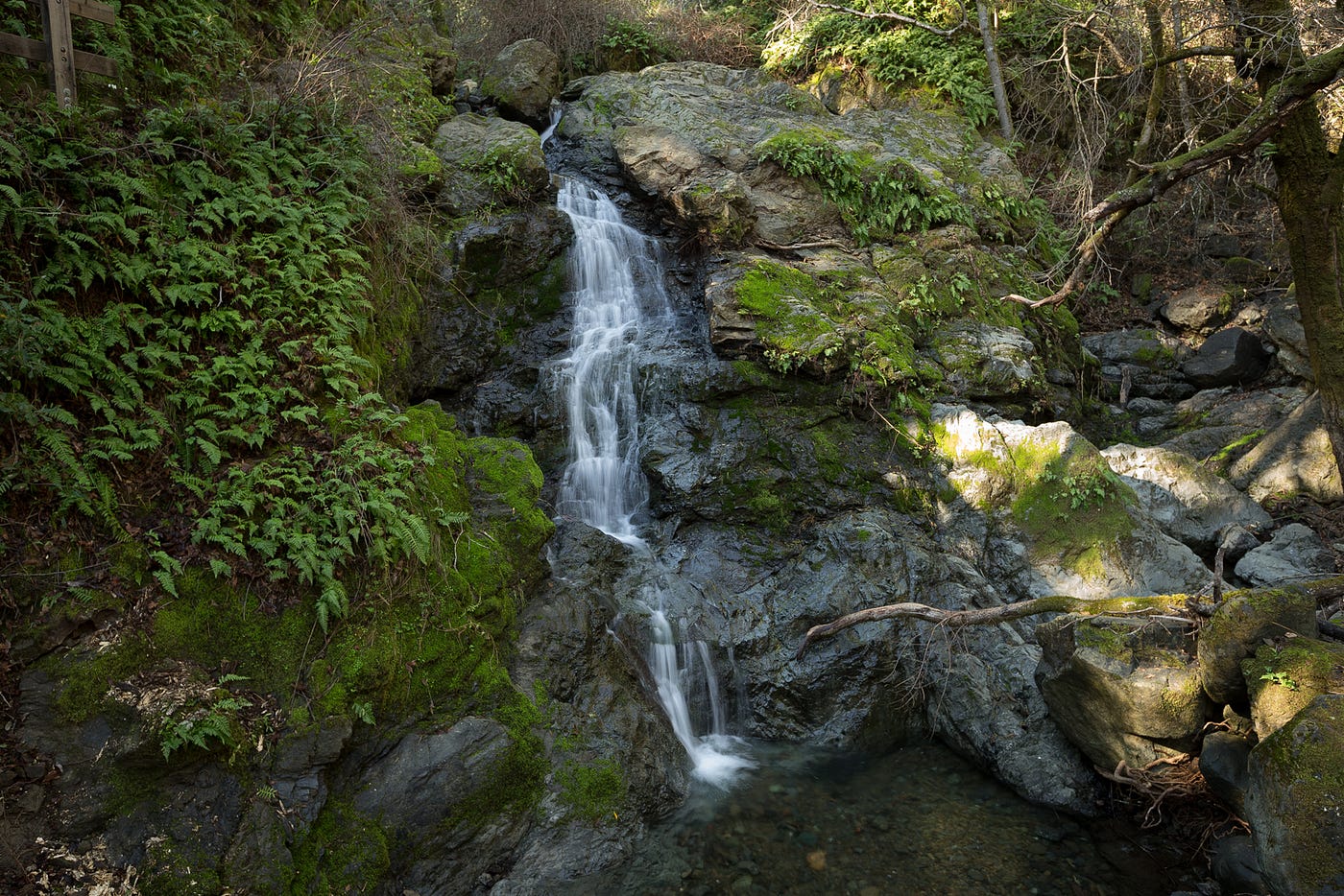
This is a quick hike to a great waterfall that you could do on a whim if you happen to be in the area. There’s a “community nature journal” in the driveway of 690 Cascade Drive near the trailhead. It has some great kid drawings and also gives a good idea of the current state of the falls. The main trail crosses San Anselmo Creek multiple times, but it’s mostly dry except after seasonal rains. In case of high water, there’s an alternate trail that follows along the north side of the creek with one bridge crossing just before the falls.
When you reach the end, there’s a perfect overlook platform on the trail and a couple of large boulders immediately in front of the falls. The trail officially ends at the falls, but if the water is low enough, you can rock-hop upstream and find some nice secluded spots. It’s important to remember, though, that San Anselmo Creek is a nursery for steelhead trout. Eggs and young fish stay in the gravel for months in the winter and spring after adults make their way upstream from the ocean. For this reason, it’s important to stay out of the water, even at low levels.
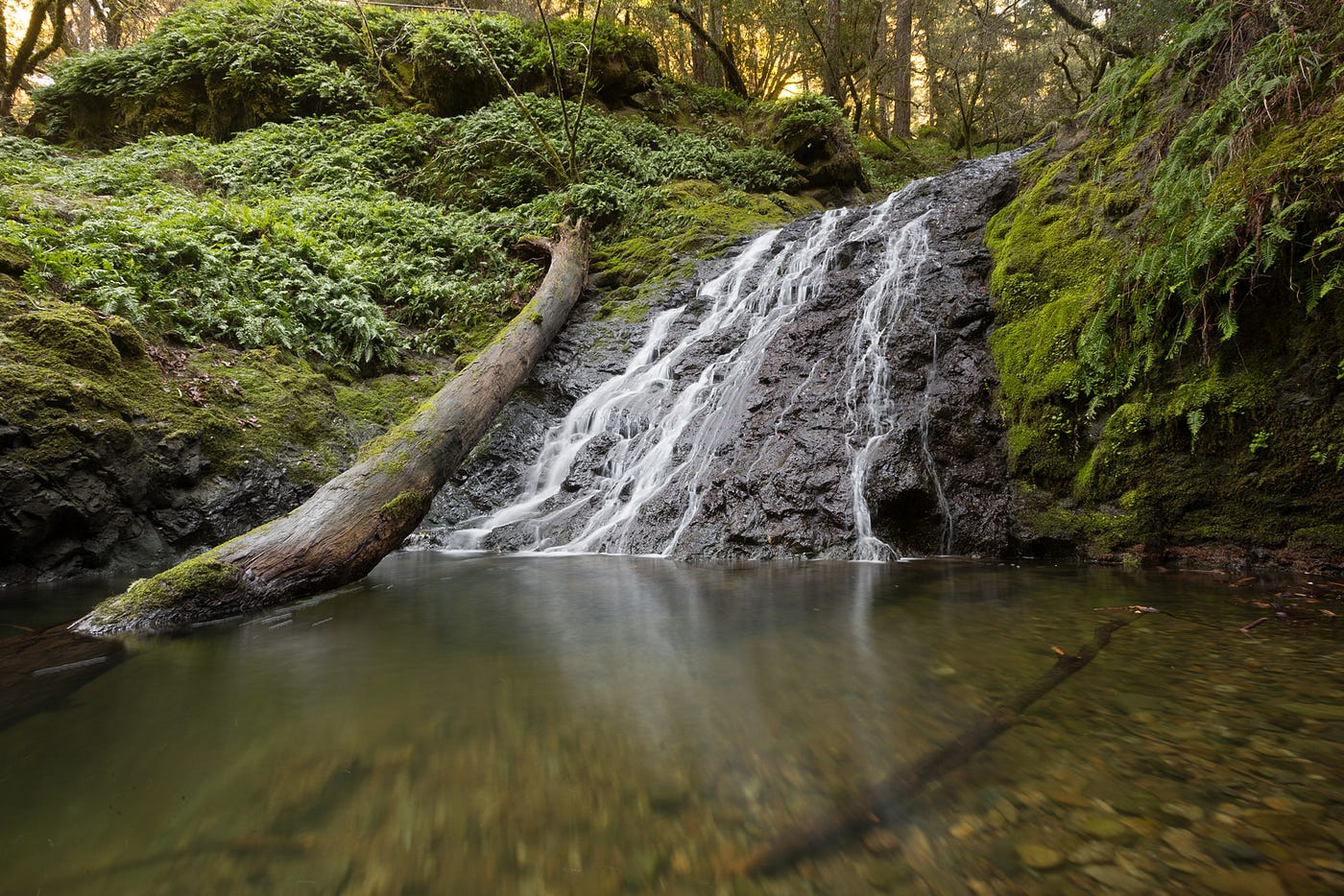
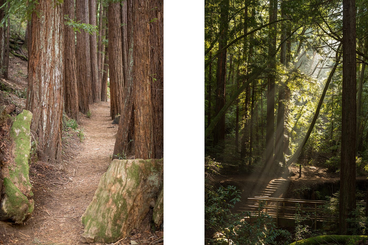
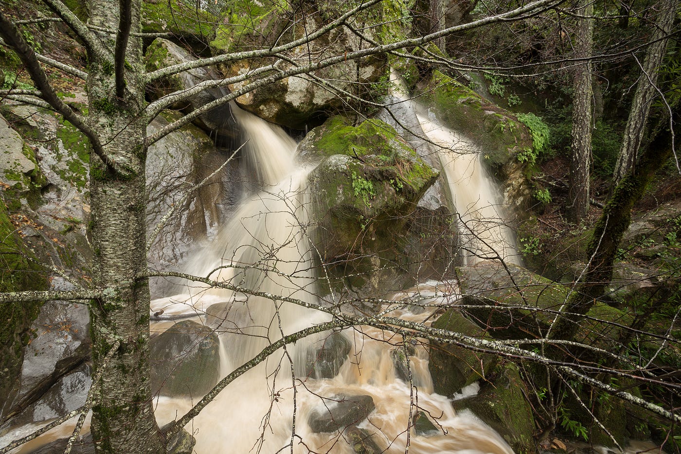
Cataract Falls
- Hiking time: 1.5 hours each way
- Total distance: 2.8 miles
- Trail difficulty: moderate
- Dogs OK on leash, no bikes
- Directions
All the falls on this list are in nice scenic areas, but this one is worth visiting if only for the drive to the trailhead. The main falls are located just east of Ridgecrest Boulevard, but the most common starting point is downstream at Alpine Lake. You’ll pass multiple falls along Cataract Creek on the way to Laurel Dell, a picnic area just past Cataract Falls. It’s a steep hike, but each ascent is worthwhile when you see the next waterfall along the way.
Almost the entire trail is covered by trees, and every surface that’s not being walked on is blanketed in moss. It’s the kind of scene where you’d expect to find fairies and gnomes. The creek fills in pools at the bottom of each waterfall that look inviting after a long hike, but swimming here is totally off-limits. Alpine Lake serves as the main source of drinking water for Marin County, and nobody likes hiker-flavored water.
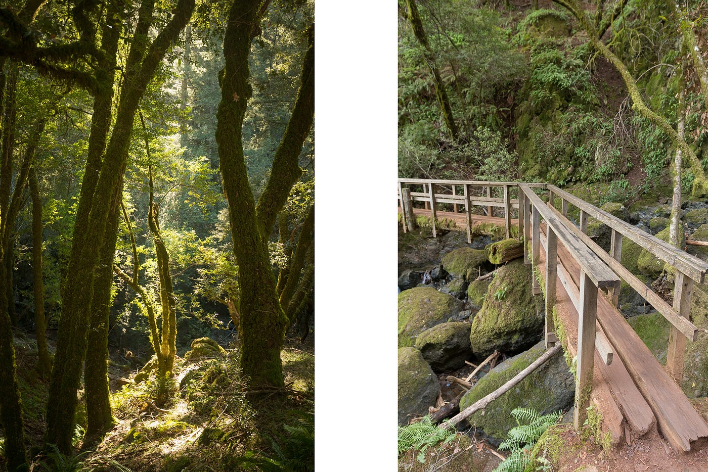
Dawn Falls
- Hiking time: 30 minutes each way
- Total distance: 2.2 miles
- Trail difficulty: easy
- Dogs OK on leash, no bikes
- Directions
The trail leads right up to the precipice of the falls, overlooking a 30-foot drop to the streambed below.
There’s also a lower waterfall that you’ll pass on the way to Dawn Falls that, while not quite as high, is definitely worth checking out. And the whole of Baltimore Canyon is absolutely gorgeous. No matter how much water is in the creek, I couldn’t imagine anyone walking away disappointed.
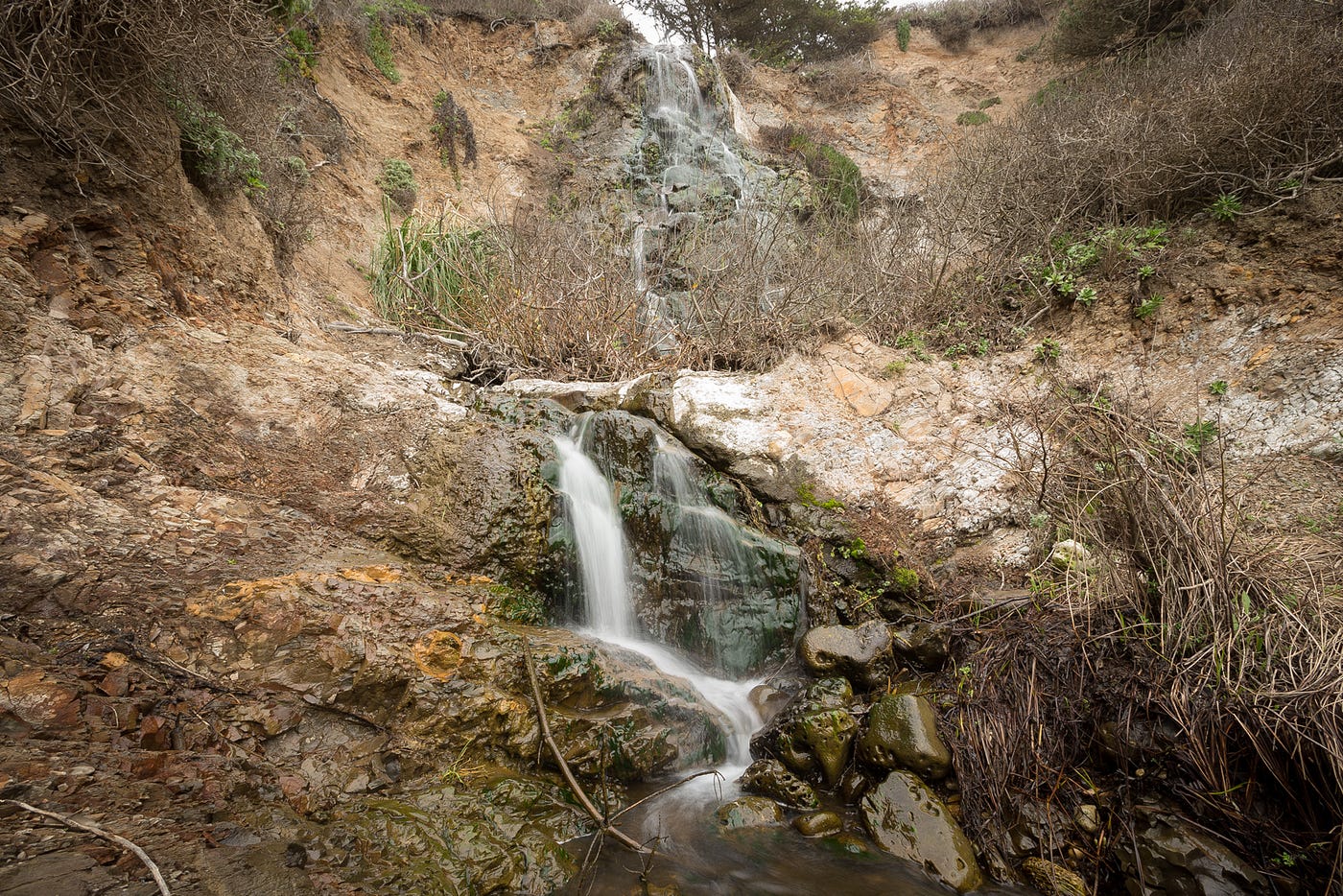
Elliot Creek Falls
- Hiking time: 20 minutes each way
- Total distance: 1.9 miles
- Trail difficulty: easy
- Dogs and bikes: No dogs at Waddell Beach or Año Nuevo, too sandy for bikes
- Directions
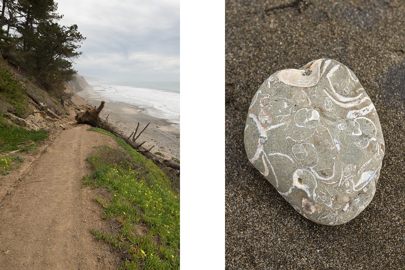
Elliot Creek flows out onto the beach just south of Año Nuevo State Park. Even if you’ve driven past it a hundred times on your way to Santa Cruz, you’d never guess there was a waterfall just off the highway. There are actually a few more within a couple of miles, but this one lasts longer than the others after a good rain. This waterfall also has a hidden talent of unearthing fossils. The three- to five-million-year-old Purisima Formation stretches along much of the coastline between San Francisco and Santa Cruz. You can find chunks of smoothed rock filled with shells scattered around the beach at low tide.
There is an old dirt road from the highway to the beach right near the falls but it passes through Coastways Ranch property. The owners have requested that visitors use one of two alternate routes nearby. From the north, you can park in the Año Nuevo lot or on the highway turnout at New Year’s Creek Road, following the paths down to the beach. If the tide is low enough, you can also park at Waddell Beach to the south. It’s a slightly longer walk (2.8 miles round-trip) but who doesn’t like long walks on a beach? Either way you go, you’ll pass other potential waterfalls, depending on recent rainfall.
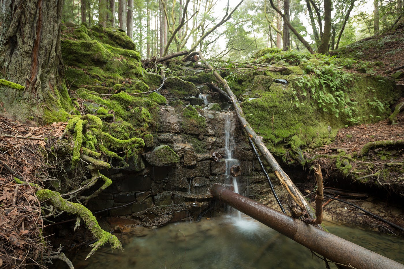
Mount Diablo Falls
- Hiking time: 3.5 hours total
- Total distance: 6.3 miles
- Trail difficulty: strenuous
- No dogs, bikes OK on fire roads only
- Directions
This isn’t the longest trail of the bunch, but with a 1,154-foot elevation difference from trailhead to trail crest, it’s definitely the most physically demanding. These falls are more dependent on rain than some of the others on this list, and a few of the bigger ones dry out a month or so after a storm. Even in times of drought, though, it’s still worth the hike. There are a few waterfalls that I couldn’t get close enough to in order to shoot well, but they’re nice to look at from afar.
The falls loop follows a few different trails, so I would suggest taking a map or writing down the directions before you go. All the trails are clearly marked at each intersection, so it’s not too hard to keep track of where you are. There’s also a map of the whole park at the trailhead. There are a number of waterfalls around the north side of Mount Diablo, and there are just as many trail combinations to get to them. Use these directions as a template if you want, and go from there: Regency Gate > Donner Canyon Road > Cardinet Oaks Road > Falls Trail > Middle Trail > Meridian Ridge Road > Meridian Point Trail > Back Creek Trail > Back Creek Road > Regency Gate.
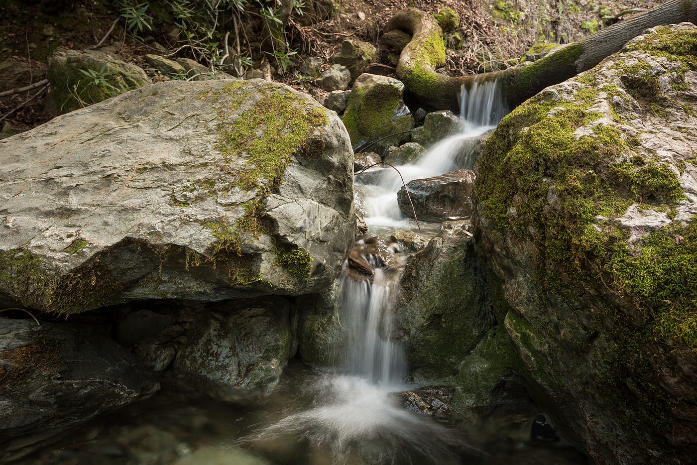
Peters Creek Falls
- Hiking time: 20 minutes each way
- Total distance: 1.8 miles
- Trail difficulty: easy
- No dogs, No bikes
- Directions

This is the kind of place that makes you feel good about the world when you stumble upon it. Even at low flow, the rocky spillway of Peters Creek is nothing short of amazing. You won’t find it on any maps, and the offshoot from the main trail is unmarked. There are multiple small waterfalls cutting grooves in the sandstone boulders at the end of the creek. The trail winds around the edge of the falls until it fades into a leafy slope.
If you’re into rock climbing, bring your shoes and a crash pad because there is some great bouldering nearby. This is easily the kind of place where you could spend a day and not see another person. The signs at the main trailhead warn of mountain lions in the area, and the leftovers from a dinner of free-range venison back up the hype.
There are two trailheads at the starting location. Take the one across the street from the parking lot. Walk through the gate, and take an immediate right turn along the wide path that follows the barbed-wire fence. This will merge with another well-worn trail. This is the Chestnut Trail. Continue until you cross a paved road. Just after the paved road, turn left. The trail is marked only by a “No bikes” and “No horses” sign. You’ll come to a clearing with an old foundation. Around the corner to the left, you’ll see the sign marking the rest of the trail. The falls are at the end of that trail. A slightly longer but maintained trail route is to take the Peters Creek Trail, then take a right on the Chestnut Trail, then follow the directions listed above.
Bonus Materials
Some of these spots are popular, with well-maintained trails, while some are mostly overlooked. Regardless of where they are, there are a few basic rules that should be followed to ensure that you and everyone else are able to enjoy them for the foreseeable future.
—Be courteous to the locals. Don’t park like an A-hole; don’t be noisy; pick up your dog’s poo; and take trash with you, even if it’s not yours.
—Be courteous to nature. Obey posted signs; watch where you step; and don’t contribute to erosion.
—Dress in layers. Temperature can fluctuate wildly in only a couple of hours, whether you’re inland or on the coast. Bring plenty of water and drink it often.
—Watch out for poison oak. If you don’t know what it looks like, look it up and avoid tromping through bushes. If you think you may have touched some, wash with cold water as soon as possible.
All photographs courtesy the author.

The Bold Italic is a not-for-profit media organization, and we publish first-person perspectives about San Francisco and the Bay Area. We operate under a fiscal sponsorship of a 501(c)(3).
You can become a paid subscriber. Or donate. Or learn more about us.